Master Navigation: Essential Map & Compass Skills for When GPS Fails
Learn critical traditional navigation skills using map, compass, and natural cues to stay safe when technology fails. Your ultimate survival guide.

Navigating the Unknown: The Art and Technology of Orientation
Navigation and orientation constitute the fundamental art and science of determining one’s position and guiding movement from one point to another. Whether traversing a dense forest or sailing open water, these skills have evolved from ancestral natural observations to precise, satellite-driven technology. While modern digital tools have revolutionized this field, the fundamentals of using a map and compass, along with natural navigation, remain critical survival skills that provide autonomy and safety when technology inevitably fails.
Using a Map and Compass: The Traditional Tools
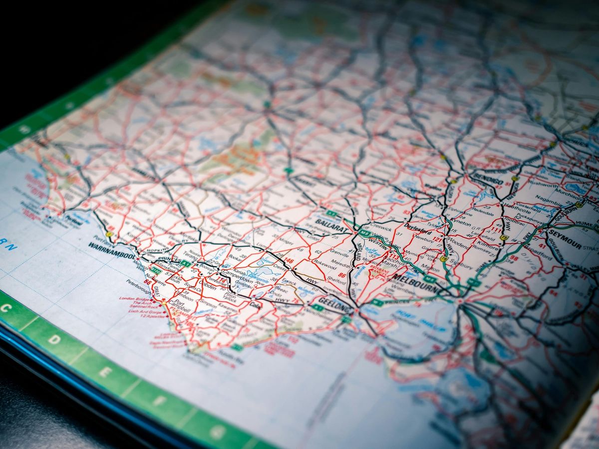
Traditional navigation centers on the use of a topographic map and a magnetic compass. A compass indicates direction relative to the Earth’s magnetic poles, while a map provides a two-dimensional representation of the three-dimensional landscape.
The first step in traditional navigation is orienting the map, which means aligning the map's north with true north in the physical environment. Once aligned, the user can accurately identify surroundings and establish their position. A crucial element in this process is accounting for magnetic declination, which is the difference between magnetic north (where the needle points) and true north (the North Pole on a map). Without adjusting for this, navigation errors can be severe.
Taking a bearing (a precise measurement of direction in degree) allows a person to follow a specific heading toward a destination. A baseplate compass, used along with a map, allows for techniques like triangulation, where bearings are taken from two or more known landmarks on a map to pinpoint one's current location. Unlike technology, these tools do not rely on batteries or signal, making them the most reliable methods for survival scenarios.
Natural Navigation: Reading the Environment
Before the invention of the compass, people used natural cues to orient themselves. Natural navigation relies on elements such as the sun, stars, and landscape features to find direction.
The Sun and Shadows: The sun rises in the East and sets in the West, offering a general sense of direction. However, for higher precision, the "shadow-stick" method can be used. By planting a stick and marking the tip of its shadow, waiting 20 minutes, and marking it again, a line drawn between the two marks indicates the East-West line, with the first mark being West. At noon in the Northern Hemisphere, the sun is to the south, and shadows point north.

The Stars: At night, Polaris (the North Star) acts as a fixed guide in the Northern Hemisphere, pointing north. It can be located by using the "pointer stars" of the Big Dipper. In the Southern Hemisphere, the Southern Cross constellation is used to find South.

Landmarks and Nature: Vegetation can reveal orientation. Mosses and lichens typically grow on the shaded, moister northern sides of trees or rocks, while southern sides tend to be warmer and drier, offering clues for navigation.
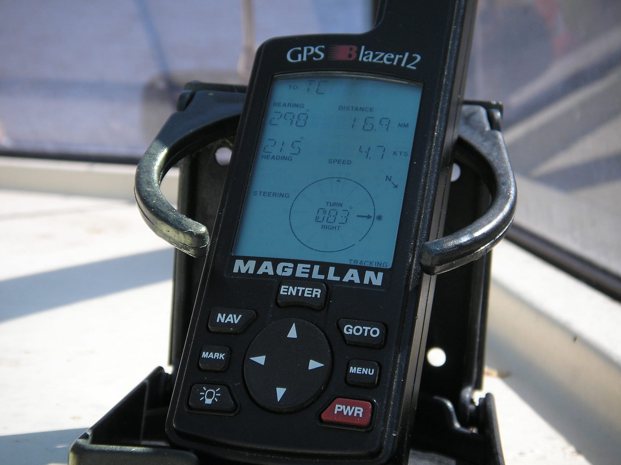
GPS and Technology: The Modern Survival Tool
In the modern era, the Global Positioning System (GPS) has fundamentally changed land navigation. These devices utilize satellite technology to provide precise, real-time location data, often accurate to within a few meters. GPS units and smartphone applications, which often include satellite imagery and topographical maps, offer immediate situational awareness.
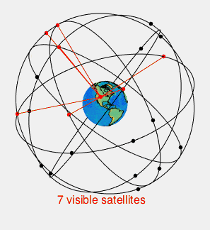
However, the role of technology in survival situations is nuanced. While high-tech devices like satellite messengers and Personal Locator Beacons (PLBs) are indispensable for transmitting distress signals, they are not flawless. They depend entirely on battery life, which can drain rapidly in cold environments or when searching for a signal. Moreover, in dense canopy, deep valleys, or urban “canyons,” signals can be disrupted, rendering the device temporarily useless.
Consequently, technology should be used to complement, not entirely replace, traditional skills. A modern adventurer best ensures safety by using a GPS for efficiency, while maintaining the knowledge to use a map and compass as a backup.
Conclusion
Navigation is more than simply following an arrow on a screen; it is understanding one’s place in the environment. Traditional methods using a map and compass, along with natural cues, provide foundational, robust skills that work regardless of electronic availability. While GPS and satellite technology offer unparalleled accuracy and efficiency, they are vulnerable to hardware failure or signal loss. Therefore, the ability to blend these modern conveniences with ancestral knowledge creates the ultimate safety net for any traveler in the wilderness.