
eLoran vs Pseudolites (2026): Anti-Jam GPS Alternatives for Resilient PNT Systems
eLoran vs pseudolites: anti-jam GPS alternatives for resilient PNT, timing integrity, and navigation in remote and contested environments.

Technical Assessment of eLoran and Pseudolite PNT for Remote and Contested Operations
Summary
The central finding is straightforward. Neither eLoran nor pseudolite networks is a credible one-for-one replacement for GNSS across the full range of civil, commercial, and military PNT use cases. They solve different problems at different scales. eLoran is the more realistic wide-area backup for timing and moderate-accuracy horizontal positioning where a national or regional terrestrial LF network exists. Pseudolites are the more realistic local replacement or augmentation method when an operator can control a bounded area, emplace multiple transmitters, and maintain synchronization and trusted transmitter coordinates. The current federal view reflected by U.S. Department of Transportation[1] and the Federal Communications Commission[2] is consistent with that conclusion: the best strategy is not a single successor to GPS, but multiple complementary technologies with different failure modes. [3]
On anti-jam performance, eLoran is the strongest wide-area option in this comparison. Its LF signal occupies a different band from GNSS, is transmitted from high-power terrestrial stations, and is materially harder to disrupt with the kinds of interference that routinely break L-band satellite reception. Pseudolites can also be highly jam-resistant inside their service bubble because their local signal power is much higher than GNSS at the receiver, and flight testing has shown usable navigation under severe GPS jamming. But that advantage is local, not continental, and it depends on the surviving availability of the pseudolite infrastructure itself. [4]
On accuracy, pseudolites are clearly superior when properly engineered. The best documented pseudolite concepts support centimeter-level carrier-phase differential operation, rapid ambiguity resolution, and highly precise local navigation. eLoran, by contrast, is a tens-of-meters class positioning system even when differentially corrected, with performance dominated by propagation modeling and calibration quality rather than elegant signal geometry. On deployability, the ranking reverses: pseudolites are locally deployable; eLoran is not. On data integrity, eLoran has the stronger native architecture because its data channel was explicitly designed to carry integrity, warning, timing, and correction information, whereas pseudolite integrity is principally a property of the local operator’s trust model, network control, and cybersecurity discipline. [5]
The practical answer to the core question is therefore narrow but useful. eLoran can meaningfully back up GNSS, especially for timing and for wide-area navigation continuity, but only where states or large operators fund and sustain the infrastructure. Pseudolites can meaningfully replace GNSS inside constrained operating areas such as mines, bases, terminals, tunnels, and landing environments, but they do not scale economically or operationally into a general national alternative. For remote and contested operations, the defensible architecture is layered: hardened GNSS first, eLoran where available for wide-area continuity, and pseudolites where local precision or denied-environment operation is mission-critical. [6]
Architecture and Operating Concept
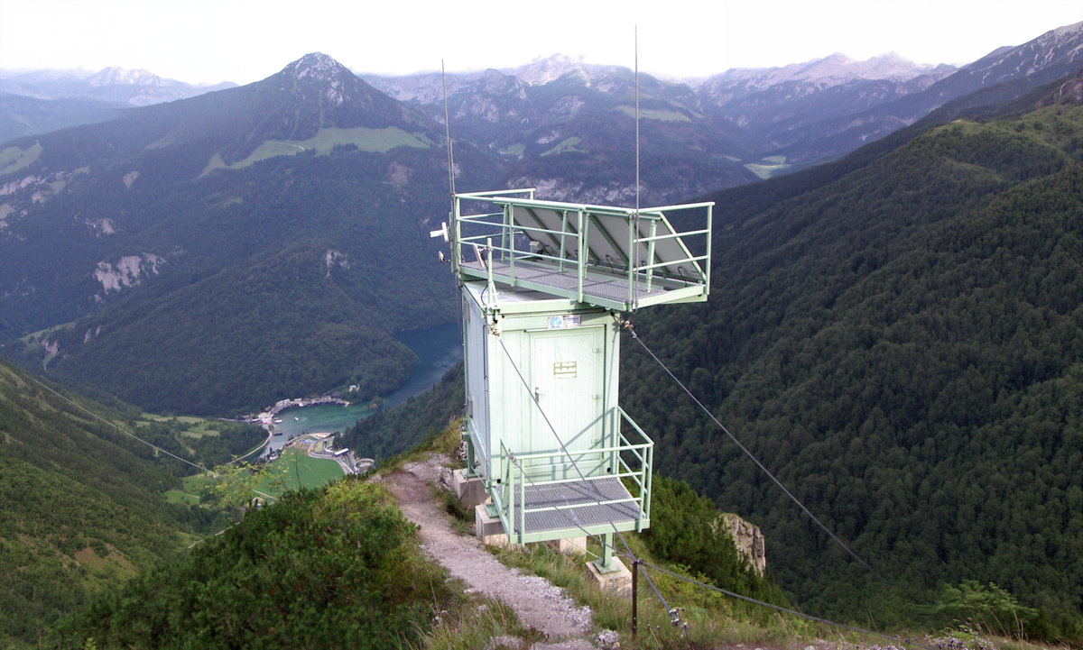
eLoran is best understood not as “old Loran revived,” but as a terrestrial PNT broadcast architecture engineered for continuity, timing traceability, and wide-area service. It operates in the 90–110 kHz LF band, uses synchronized high-power transmitting stations, and computes position through time-difference-of-arrival across transmitter pairs. The signal is groundwave-based rather than line-of-sight, which is why it can cover long distances and penetrate environments that are poor for L-band satellite reception. The modernized system adds a data channel that can carry station identity, UTC information, warnings about anomalous propagation or signal failure, authentication-related messaging, and both differential eLoran and differential GNSS corrections. [7]
Pseudolites are architecturally different. They are ground-based transmitters that emulate satellite ranging signals inside a local area. In the simplest model, the user receiver solves pseudorange to known terrestrial emitters instead of to satellites. In the more sophisticated model, pseudolites are paired with carrier-phase differential GPS or GNSS workflows so that they rapidly initialize ambiguities, maintain local geometry, or continue ranging where satellite visibility is poor or absent. The most important engineering consequence is scale: a viable service area needs multiple transmitters, generally four or more, and those transmitters must have well-known positions and sufficiently stable timing. [8]
This difference in architecture sets the entire trade space. eLoran is a sparse, regional-to-continental broadcast network with relatively few towers and many users. Pseudolites are dense, local emitters with comparatively few users per bubble and much stronger dependence on geometric layout. That is why eLoran lends itself to national timing resilience, maritime backup, and broad-area continuity, while pseudolites lend themselves to controlled local operations such as precision landing, mining, robotics, underground mobility, and forward operating areas. [9]
Anti-Jamming and Signal Resilience
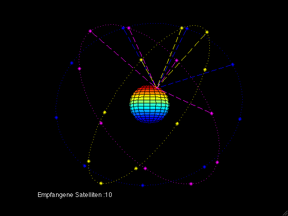
GNSS remains intrinsically fragile to power-balanced interference because the received signal at the user antenna is weak and concentrated in shared satellite-navigation bands. Federal sources continue to describe GPS interference as a transportation-safety and critical-infrastructure risk, and RAND’s assessment notes that deliberate noise jamming can likely deny all GNSS signals because they share weak-space-signal characteristics and overlapping frequency neighborhoods. In engineering terms, that makes GNSS exquisitely scalable when unopposed and unusually brittle when deliberately challenged. [10]
eLoran’s anti-jam advantage is real, but it is often overstated in casual discussion. The robust part is clear: it rides in a different spectrum band, permitted transmitter power is measured in hundreds of kilowatts to around a megawatt, and the large antenna systems needed to radiate efficiently at 100 kHz make opportunistic spoofing and jamming materially harder than for GPS. MITRE’s interference study concluded that intentional interference against eLoran faced major practical barriers, and even a modeled 100 W EIRP jammer reduced nominal sea-water coverage rather than simply collapsing service outright; the system’s robustness was further helped by overlapping chain coverage. That does not make eLoran unjammable, but it does make it much harder to jam with small, cheap, field-expedient equipment. [11]
Pseudolites can outperform eLoran locally under active jamming because they generate a high-SNR signal where the user actually operates. Early battlefield and flight-test work showed that pseudolite constellations could supply a higher-power navigation signal to receivers under severe GPS jamming, including a demonstrated 10 m navigation solution in severe jamming conditions. More recent Army characterization work also treated pseudolites explicitly as area-protection tools in GPS-challenged environments. But the same sources also point to the core limitation: the anti-jam benefit exists only where the constellation exists, where its timing remains coherent, and where the transmitters themselves have not been found, attacked, or co-opted. [12]
For remote civilian environments, that means the balance is asymmetric. eLoran is valuable when the operator needs coverage across a coast, a rural region, or a large logistics footprint and can rely on a sovereign network. Pseudolites are better when the operator needs continuity inside a mine, terminal, tunnel, processing plant, or expeditionary site. For contested environments, pseudolites are tactically powerful but strategically brittle; eLoran is strategically attractive but only where the large fixed infrastructure already exists. [13]
Differential Corrections and Accuracy
eLoran’s accuracy ceiling is not set by weak signal strength. It is set by propagation uncertainty. RAND’s technical appendix is explicit that Additional Secondary Factor, the terrain-dependent component of groundwave delay, is the hardest eLoran error source to model, and that soil moisture and conductivity changes are major uncertainty drivers. Differential eLoran exists primarily to correct those local propagation errors. The same source notes that one reference station can support precision eLoran only over roughly a 35-mile radius, which means usable precision depends on a nontrivial calibration network rather than on the transmitter chain alone. With those corrections, positioning around 20 m is plausible, and some models suggest better than 10 m in favorable conditions. [14]
The time domain tells a similar story. Modernized eLoran field work associated with National Institute of Standards and Technology [15] and related technical papers reports sub-microsecond timing without differential corrections and roughly 100 ns or better with data-channel-assisted corrections; one frequently cited modernization paper reports that eLoran met 8–20 m harbor-entrance and nonprecision-approach requirements while also supporting UTC recovery to about ±50 ns RMS. That is strong performance for timing resilience, but it is still not an argument for replacing GNSS as the primary high-accuracy positioning layer. [16]
Pseudolite systems sit at the opposite end of the accuracy trade. Work from Stanford University [17] demonstrated that simple pseudolites could initialize carrier-phase differential navigation to centimeter-level accuracy in real time and reduce ambiguity-resolution delay from the order of ten minutes to seconds. That matters operationally because pseudolites are not just another local ranging source; in the strongest implementations they are ambiguity enablers for CDGPS-class precision. Field work further showed self-calibrating pseudolite arrays capable of autonomously localizing deployed beacons to under 5 cm RMS, which directly addresses one of the main objections to ad hoc fielding. [18]
The constraints are equally real. ION literature repeatedly identifies near-far effects, nonlinear observation behavior at short ranges, multipath, and constellation layout as dominant problems for pseudolite accuracy. In practice, the question is not whether pseudolites can achieve centimeter-level precision. They can. The question is whether a specific deployed geometry, with real synchronization, real multipath, and real receiver dynamics, can do so reliably enough for the intended operation. That is why pseudolites are strongest in surveyed, controlled, and procedurally managed local areas, not in improvised broad-area navigation. [19]
Data Integrity and Spoofing Resistance
Availability is not integrity. A system that stays on the air can still produce a false answer. That distinction matters because GPS disruption is not limited to signal loss; spoofing can preserve apparent continuity while corrupting position or time. Federal resilience guidance also notes that much user equipment was not originally designed with robust fallback or integrity logic. In other words, the engineering problem is not merely “keep receiving something.” It is “know whether what is being received should be trusted.” [20]
eLoran has an architectural advantage here because integrity and warning functions are part of the service design rather than an afterthought. The Loran Data Channel was defined to carry anomalous-propagation warnings, signal-failure warnings, station and UTC identity information, corrections, and even authentication-related messages. That does not make every implementation cryptographically secure, and modern civil deployments remain fragmented, but it does mean that eLoran can expose quality and trust information through the signal itself. Combined with terrestrial geometry, transmitter synchronization, and the difficulty of radiating convincing high-power LF counterfeit signals, spoofing eLoran is operationally harder than spoofing an unaided civil GNSS receiver. [21]
Pseudolite integrity depends far more on governance than on waveform. In a tightly controlled network with known transmitter coordinates, controlled timing, and secure command paths, pseudolites can support very high-integrity local navigation; the early integrity-beacon landing work was developed for precisely that reason. But the trust model is local. If transmitter coordinates are wrong, if synchronization drifts, if the operator’s reference station is compromised, or if the command-and-control plane is penetrated, the user can receive a strong, clean, internally consistent wrong answer. The same-carrier architectures also face a distinct integrity challenge: if they interfere with or masquerade as GNSS without clear coexistence rules, the line between augmentation and contamination becomes operationally dangerous. [22]
Deployment Models for Remote Environments
eLoran is capital-intensive and politically contingent. The infrastructure model is large fixed towers, synchronized control, and a support network of monitor and reference sites. RAND’s notional analysis estimated that only four transmitters might support continental-scale 1 µs timing service, but differential eLoran and precision fixed-user timing would still require a much denser reference-site layer, and wide-area mobile PNT would require roughly twenty or more transmitters. That is technically achievable, but it is not an expeditionary model. It is a state, alliance, or major national-infrastructure model. [23]
Current policy signals reinforce that point. As of early 2024, the federal decision in the United States was not to take transfer of legacy Loran properties from the U.S. Coast Guard[24] after the commercial eLoran RFI produced no respondents claiming a need for those properties. By contrast, Ofcom[25] now has a licensing path for eLoran operation in the 90–110 kHz band, indicating continuing regulatory openness even though that is not equivalent to a sovereign nationwide build-out. Operationally, that means eLoran is best treated today as an available or potential regional backup where governments choose to sustain it, not as a universally fieldable backup waiting to be switched on. [26]
Pseudolites are the opposite. They are operationally plausible in remote, infrastructure-limited settings precisely because they can be brought to the site. The historical literature covers open-pit mining, aircraft landing, rover navigation, and military area protection; newer military testing continues to treat them as a practical denied-GPS tool. Self-calibrating array concepts further reduce the pre-survey burden, which is important for austere deployments. The price paid is persistent local support: power, synchronization, geometry management, site security, maintenance, and receiver compatibility. [27]
For remote operators, the practical distinction is therefore stark. If the requirement is “keep a mine, tunnel complex, port terminal, or forward base running accurately when GNSS is obstructed or jammed,” pseudolites are a realistic answer. If the requirement is “preserve regional maritime or timing continuity across a coastline, inland logistics corridor, or national infrastructure network,” eLoran is the stronger answer, but only if somebody has already paid to build the network. [28]
Failure Modes and System Risks
eLoran breaks where network density, calibration, or site survivability are insufficient. Sparse tower networks create geometric and coverage limits. ASF modeling errors and seasonal ground-conductivity changes directly degrade accuracy. Fixed transmitting sites also concentrate risk: they are easier to identify and harder to move than distributed local systems, which means physical attack, sabotage, or long-duration outage at a few nodes can have outsized effects. The system is resilient to ordinary GNSS-style jamming, but it is not resilient to the absence of a funded network. [29]
Pseudolites break earlier at the receiver and geometry level. The near-far problem is fundamental because nearby terrestrial emitters can overwhelm weaker ones. Co-site interference, poor dilution of precision from bad placement, dual-solution behavior, transmitter-location errors, and synchronization drift are all well-documented problems. RAND also notes that same-carrier pseudolites would have to prove compatibility with GNSS before they could be entertained as a viable broad backup, an unusually high regulatory and technical bar. In short, pseudolites fail locally and technically; eLoran fails strategically and infrastructurally. [30]
Hybrid Architectures and Final Assessment
The weight of current evidence points toward layered PNT rather than replacement PNT. DOT’s current strategic plan explicitly calls for multiple and diverse complementary technologies for national critical functions, and the FCC’s 2025 inquiry frames the same problem as developing a robust, resilient “system of systems.” That language is not rhetorical. It reflects the empirical result of the last decade of technical assessments: no single terrestrial alternative simultaneously matches GNSS on global reach, low user cost, precision, timing scale, and deployability. [31]
In that layered architecture, GNSS remains the primary global PNT layer because nothing else duplicates its scale and installed base. eLoran is the best fit for wide-area continuity, trusted timing, and moderate-accuracy backup where sovereign terrestrial infrastructure can be justified. Pseudolites are the best fit for local high-precision service bubbles in denied or obstructed environments. A rational remote-operations stack therefore looks like hardened multi-GNSS plus inertial and receiver toughening as the baseline; eLoran where regional terrestrial coverage exists or can be politically funded; and pseudolites where the mission requires precise local continuity under blockage, jamming, or spoofing risk. [32]
The non-hedged conclusion is this. eLoran can meaningfully augment GNSS and, in some national timing and broad-area navigation roles, can serve as a genuine backup. Pseudolites can meaningfully replace GNSS only inside bounded local areas, and they are best treated as precision local augmentation or local-area replacement rather than as a strategic backup layer. GNSS therefore remains primary, but fragile; eLoran is the more credible resilient wide-area backup; pseudolites are the more credible high-precision local substitute. For remote and contested operations, the question is not which one wins. The correct answer is that each occupies a different layer in a resilient PNT architecture. [33]
Open Questions and Limitations
The engineering case for both technologies is stronger than the deployment case. For eLoran, the unresolved variable is not physics but institutional commitment: current U.S. policy has not funded a national build-out, while other jurisdictions have only partial regulatory or trial activity. For pseudolites, the unresolved variable is not local accuracy but scalable operationalization: receiver compatibility, coexistence rules, cybersecurity, and sustainment remain highly deployment-specific. Those limits do not change the main conclusion, but they do mean that viability still depends less on laboratory performance than on who owns, operates, defends, and pays for the network. [34]

Citations
[1] [2] [4] [7] [11] [13] [17] [25] [34] Ofcom. (2023). Spectrum access for Enhanced Long-Range Navigation (eLoran) systems at 90–110 kHz. https://www.ofcom.org.uk/spectrum/radio-equipment/enhanced-long-range-navigation
[3] [10] [33] U.S. Department of Transportation. (2023). Commercial eLoran capability. Federal Register. https://www.govinfo.gov/content/pkg/FR-2023-10-03/pdf/2023-21767.pdf
[5] [21] Montgomery, K., & Lombardi, M. A. (2008). PTTI capabilities of the modernized LORAN system. National Institute of Standards and Technology. https://rntfnd.org/wp-content/uploads/NIST-Paper-on-Modernized-Loran-.pdf
[6] [15] [28] [31] U.S. Department of Transportation. (2025). Positioning, navigation, and timing strategic plan. https://www.transportation.gov/pnt/dot-positioning-navigation-timing-pnt-strategic-plan
[8] [9] [14] [23] [29] [32] Shostak, M., Stanley, K. D., Stickells, A., Vermeer, M. J. D., & Worman, S. M. (2021). Analyzing a more resilient national positioning, navigation, and timing capability. RAND Corporation. https://www.navcen.uscg.gov/sites/default/files/pdf/waterways/shallow_draft/RAND_RR2970.pdf_safe.pdf
[12] Tuohino, J. L. (2000). Military pseudolite flight test results. Institute of Navigation. https://www.ion.org/publications/abstract.cfm?articleID=1623
[16] National Institute of Standards and Technology. (2021). NIST recommends steps to boost resilience of U.S. timekeeping. https://www.nist.gov/news-events/news/2021/11/nist-recommends-steps-boost-resilience-us-timekeeping
[18] Cobb, H. S. (1997). GPS pseudolites: Theory, design, and applications [Doctoral dissertation, Stanford University]. https://web.stanford.edu/group/scpnt/gpslab/pubs/theses/StewartCobbThesis97.pdf
[19] [24] [30] Madhani, P. H. (2001). Mitigation of the near-far problem by successive interference cancellation. Institute of Navigation. https://www.ion.org/publications/abstract.cfm?articleID=1709
[20] U.S. Government Accountability Office. (2022). GPS disruptions: DOT could improve efforts to identify interference incidents and strengthen resilience. https://www.gao.gov/assets/820/814138.pdf
[22] Warburton, J., Wullschleger, V., & Velez, R. (1997). FAA flight test results using airport pseudolites with the LAAS test prototype (LTP). Institute of Navigation. https://www.ion.org/publications/pdf.cfm?articleID=2885
[26] U.S. Department of Transportation. (2024). U.S. Coast Guard Loran sites. Federal Register. https://www.govinfo.gov/content/pkg/FR-2024-02-21/pdf/2024-03495.pdf
[27] Stone, J. M. (1999). GPS pseudolite transceivers and their applications. Stanford GPS Lab. https://web.stanford.edu/group/scpnt/gpslab/pubs/papers/Stone_IONNTM_1999_GPS_PL_apps.pdf